
At Beckett Rankine we are increasingly using Unmanned Aerial Vehicles (UAV), or drones, as a survey tool to provide high quality information and imagery for condition and as-built surveys as well as for conceptualisation work and planning.
The latest drones have the capability to efficiently provide both widespread and detailed views of sites that may not be otherwise accessible without compromising health and safety standards. The advantages of adopting drone survey technology can be reduced cost and survey duration as well as a reduction in the risk of injury.
Typical recent applications have provided condition and mapping surveys – the tool acquires bathymetric data, photogrammetry and detailed video imagery. This data acquisition has provided a variety of perspectives of sites and structures which, in some cases, could not be acquired by any other means.
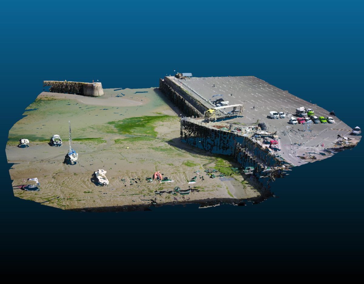
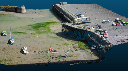
Folkestone Harbour’s RoRo Ramp inspection is an example of the use of a drone to determine the condition of an open jetty structure where very soft mud made access on foot problematic:
Footage was also captured of the adjacent quay wall as shown:
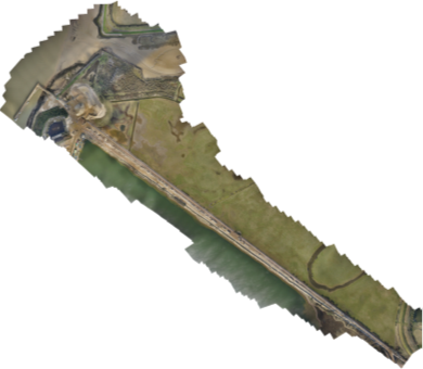
Survey data acquisition has been made simpler and safer and has proven a reliable tool for the provision of point-clouds and contour mapping as shown at Cliffe Jetty, along the River Thames. For this project the drones provided the following information:
- Contour plotting at 0.25-metre and 1-metre levels;
- Point cloud data in XYZ format;
- Orthographic images;
- Digital surface modelling;
The above data sets were harnessed for developing a scheme for the extension of the jetty.
Below is a comparison between open-source digital surface modelling and drone-acquired contour plotting.
The drone survey carried out on Cliffe Jetty took place over two days and covered a total area of approximately 65 Hectares. The drones scanned from 50m above ground level and provided level data to the nearest centimetre.
Photogrammetry was carried out for both projects as the drones also took hundreds of photographs running along a single set plane approximately 50m above surface level. The resultant orthographic and mapping images produced are as follows:
Drones have been in use for surveying for around six years during which time their capability and accuracy has developed exponentially. Drone technology is still in its infancy and it will be fascinating to see what further capabilities are added over the next decade. There are already proposals to use drones for line handling between tugs and ships and for life saving at sea; might we also see developments in the use of drones for marine construction work?
